Sapporo does winter like other cities do rush hour — as identity, not inconvenience. From Sapporo Sosei Square, a 28-story commercial tower on the edge of downtown, this live camera looks across the grid toward Ōdōri Park and the red steel lattice of the Sapporo TV Tower, the city’s most recognizable vertical punctuation. You are watching Hokkaido’s capital (~1.9 million people in the municipality) breathe: snow falling on park trees, office lights warming at dusk, festival scaffolding appearing in February, and the wide northern sky doing things Tokyo cameras rarely see. It is a cityscape cam with weather drama baked in.
About This Live Camera
The feed streams from Sapporo Sosei Square in Chūō-ku (Central Ward), positioned to capture a panoramic slice of central Sapporo. The Sapporo TV Tower — 147.2 m tall, built for 1957 broadcast needs and now a tourist observation deck — typically appears to one side of the frame, rising from the eastern end of Ōdōri Park. Beyond and around it spread mid-rise commercial buildings, traffic arteries, and the long green band of the park itself, which divides north and south Sapporo in the city’s American-inspired grid plan.
Operators present the stream as a weather and cityscape reference: useful for checking snow intensity, visibility, festival build-up on Ōdōri, and general atmospheric mood before a trip. Broadcast may pause for maintenance or technical reasons; treat availability as best-effort rather than guaranteed 24/7.
What You Can See
Sapporo TV Tower anchors orientation — red framework, observation deck silhouette, sometimes night illumination schemes tied to events. Ōdōri Park runs east–west as a tree-lined corridor; in winter it hosts Snow Festival sculpture zones (though individual sculptures may be distant at this zoom). Traffic on surrounding streets pulses with commuter and tourist flow. Building rooftops accumulate snow in winter, revealing Hokkaido’s seasonal character faster than any temperature number.
Sky delivers half the show: low winter sun, fast-moving cloud fronts, occasional diamond dust sparkle in cold air, summer cumulus stacking over the Ishikari Plain. Susukino nightlife district lies south of the park — not always visible directly, but light pollution at night hints at the city’s after-dark economy.
Framing varies with camera maintenance; winter operators sometimes adjust direction to protect equipment from ice — a practical northern habit worth expecting.
Location
Sapporo sits on the Ishikari Plain in southwestern Hokkaido, Japan’s northernmost major island. Sosei Square stands near the Sosei River and the southern edge of Ōdōri, placing the camera in the heart of the Chūō-ku administrative and commercial core. JR Sapporo Station lies roughly 1 km north — walkable via underground passages and surface streets. Tanukikoji arcade and Minami 1-jō traffic corridors sit within a few minutes’ walk south and east.
The city’s grid — jō running east–west, chōme north–south — makes navigation unusually logical for Japan. Numbered addresses decode into predictable blocks; the cam shows that geometry from above-street elevation.
History
Sapporo’s modern story begins with Hokkaido’s Meiji-era development: the Kaitakushi (Development Commission) laid out a planned capital in the 1870s, importing Western-style surveying and boulevards. Ōdōri was designed as a firebreak and civic spine; it became a park corridor instead of empty void. Sapporo TV Tower (1957) symbolized postwar media modernity and remains a festival-time beacon.
The 1972 Winter Olympics cemented global awareness — Okurayama and Miyanomori jumps still visible from certain city angles. Sapporo Snow Festival grew from 1950 student snow sculptures to a multi-site event drawing 2 million+ visitors some years. Sapporo Beer (1876) predates the city’s fame but flavors its brand — beer gardens, the Sapporo Beer Museum in Higashi-ku, and summer mug culture.
Sosei Square itself belongs to the contemporary commercial layer — office tenants, retail, and a camera that turns private rooftop infrastructure into public window on the city.
Why Watch
Because Hokkaido weather is a protagonist. Mainland Japan cams rarely show -10°C clarity and park-wide snow events at this scale. Because Snow Festival planning is visible weeks before opening — cranes, truck traffic, snow delivery convoys. Because pairing this view with JR Sapporo Station teaches how a northern capital moves people while looking calm from a tower.
Remote viewers use the cam for nostalgia, trip timing, and quiet background — city life without Shibuya’s density, but with equal seasonal honesty.
Daily Life
Morning commuters cross Ōdōri’s intersections toward government offices, banks, and department stores (Daimaru, Mitsukoshi). Lunch crowds hit park benches in summer; winter sees bundled walkers on cleared paths. Salarymen and students share Sapporo Subway lines (Namboku, Tōhō, Tōzai) beneath the visible surface. Tourists photograph the TV Tower from ground level while this cam captures their tiny presence from above.
Evening brings amber window grids and early darkness in midwinter — Sapporo’s sunset can feel politely early, as if the city agreed to let you get to dinner on time. Weekend joggers, festival volunteers, and Yosakoi rehearsal groups use Ōdōri as civic living room.
Best Time of Day
- Sunrise to mid-morning: Crisp winter light; commute activation; sometimes pink snow tones.
- Midday: Best for reading weather and park detail; summer greenery strongest.
- Late afternoon: Long shadows across grid streets; golden hour on TV Tower steel.
- Night: Illuminated tower, office floors, traffic headlight rivers — especially atmospheric during White Illumination season.
Before Snow Festival opening, daytime hours reveal construction progress on snow blocks.
Best Seasons
Winter (December–March) is signature Sapporo — snow on rooftops, festival builds in late January/early February, cold-air clarity after fronts pass. Spring melt exposes brown park earth then sudden cherry blossoms in May. Summer brings beer gardens, Yosakoi Soran Festival (June), and mild heat rare by mainland standards. Autumn crispness and early Illumination installs make October–November underrated for cityscape colour.
Typhoon remnants occasionally reach Hokkaido as rain; winter blizzards can white-out the frame entirely — educational for understanding why Sapporo drivers own serious tires.
Events
Sapporo Snow Festival (main Ōdōri site, typically early February) transforms the park into a sculpture gallery — the cam may catch cranes and snow walls even if individual art is distant. Sapporo White Illumination lights downtown from November into winter. Yosakoi Soran Festival fills streets with dance teams in June. Sapporo Autumn Fest (September, beer and food stalls at Ōdōri) and Marathon day ( autumn) spike foot traffic.
New Year’s ceremonies, Hokkaido Shrine pilgrimage season (January), and Christmas markets add recurring rhythms visible as crowd density and lighting changes rather than close-up detail.
Getting There
Fly into New Chitose Airport (CTS) — live airport view — then JR Rapid Airport ~37 minutes to JR Sapporo Station. Subway from station to Ōdōri or Susukino is minutes. Domestic flights connect Sapporo to Tokyo, Osaka, Sendai, and regional Hokkaido airports.
On foot from Ōdōri Station, the TV Tower and park are immediate. Tanukikoji arcade lies south; Minami 1-jō traffic cam covers a nearby arterial intersection. Winter visitors should plan subway-underground routes — Sosei and station malls link heated corridors.
Interesting Facts
- Sapporo is Japan’s fifth-largest city and Hokkaido’s only designated major city by cabinet statute.
- Ōdōri Park spans roughly 1.5 km east–west through central Sapporo — twelve blocks of green.
- Sapporo TV Tower predates Tokyo Tower and was a technological symbol in 1957.
- The city hosted the 1972 Winter Olympics — the first in Asia.
- Sapporo Beer, founded 1876, is among Japan’s oldest beer brands.
- Sapporo’s grid plan was influenced by American-style surveying under Kaitakushi advisors.
- Average January highs hover around -1°C; snowfall is substantial but less extreme than mountain resorts.
- Clock Tower (1878) and Former Hokkaido Government Office (Red Brick) are short walks from Ōdōri — not in this frame but part of the same walkable core.
Watching Winter Arrive on a Grid
Count rooftops whitening — Sapporo snow seldom spares flat surfaces. Note traffic speed drop as flakes thicken; northern drivers adjust early. When the TV Tower vanishes into grey, you are seeing why festivals become citywide morale events rather than tourist extras. After storms, watch shovel brigades on park paths — community labour visible as moving dots.
Compare midday and midnight during Illumination: the same grid becomes two cities. Summer viewers should note how late the sky stays bright — Hokkaido twilight rewards patience.
The Tower as Clock and Thermometer
Locals mentally use the TV Tower as orientation — losing sight of it means you walked too far south into Susukino or north toward the station. On the cam, its lighting schemes sometimes announce seasons or charity campaigns. Observation deck hours mean tiny ant climbers in summer; winter visibility days offer Ishikari Plain and Mount Moiwa context from the real deck — the cam is the free preview.
Pair audio from city imagination: no sound on stream, but you can nearly hear yatai stalls setting up when snow festival scaffolding appears. That synesthetic habit is what makes cityscape cams belonging, not tourism.
Winter coats on this feed are a packing reality check — start with the Japan winter packing list before you underdress a Hokkaido week.
Nearby Live Cameras
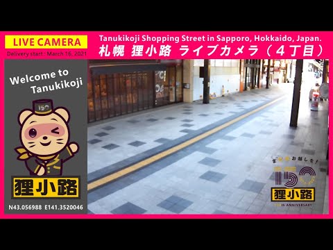
Extend your Sapporo circuit: JR Sapporo Station for platform snow and airport-line departures, Tanukikoji Shopping Street for covered arcade life south of Ōdōri, and Minami 1-jō Avenue for street-level traffic near Sapporo Factory and Bus Center-mae subway.
Frequently Asked Questions
Can I see Snow Festival sculptures on this camera?
You may see construction activity and large snow masses on Ōdōri, but detailed sculpture faces are usually too distant. Ground-level festival cams and on-site visits show art best.
Where exactly is the camera?
On or within Sapporo Sosei Square, a 28-story building near the Sosei River and southern Ōdōri edge in Chūō-ku.
Is the Sapporo TV Tower always visible?
Usually it is a primary landmark in frame, but seasonal maintenance or anti-ice repositioning can shift the angle temporarily.
How far is JR Sapporo Station?
Roughly 1 km north — about 10–15 minutes walk via underground malls or surface streets.
Does the stream run 24 hours?
Not guaranteed. Treat the feed as best-effort live; interruptions happen for maintenance and broadcaster schedules.
What is the best season for this view?
Winter for snow cityscape; February for festival build-up; summer for green park contrast and Yosakoi energy nearby.