Kanazawa opens to the sea the way it opens to gardens and gold leaf — quietly, with centuries of practice behind the polish. The port is not the postcard most visitors chase first; Kenroku-en and the teahouse districts hold that honor. Yet the harbor is where the city learned trade, weathered isolation, and rebuilt itself as a modern gateway. A live camera here watches water that carried Kitamae-bune cargo ships, container vessels bound for Busan and Shanghai, and cruise passengers stepping ashore to discover a castle town that never burned.
About This Live Camera
The stream looks across Kanazawa Port and the lower reaches of the rivers that define it — chiefly the Ono River and the Sai River, both flowing from the mountains through the city before meeting the Sea of Japan (known internationally also as the East Sea). Expect a working waterfront rather than a beach resort frame: quays, cargo movement, fishing activity near historic Ono and Kanaiwa districts, and — on lucky days — the silhouette of a cruise ship at the terminal.
Because this is an industrial and commercial harbor, the mood shifts with shift changes, tide, and season. Winter can bring grey skies and snow flurries sliding down from the Hokuriku sky; summer light turns the water glassy in late afternoon. The camera does not perform for tourists. It documents a port that still earns its keep.
What You Can See
On clear days you may spot container cranes, Ro-Ro ramps for vehicles and machinery, fishing boats returning to the Ono area, and the broad geometry of breakwaters that protect the excavated basin. The Kanazawa Port Cruise Terminal, opened in 2020, sits within this complex — a sign of how seriously Ishikawa treats seaborne tourism.
Closer to the traditional port towns, views can include Ono Port activity: small vessels, waterfront roads, and the low-rise fabric of neighborhoods that once housed merchants who financed Kitamae trade. You will not see Kenroku-en from here; you will see the economic spine that helped pay for culture inland.
Location
Kanazawa Port occupies the central stretch of Japan’s Sea of Japan coast in Ishikawa Prefecture, on the west side of Honshu. The harbor incorporates the mouths of the Ono and Sai rivers and extends into a dredged, excavated basin — a relatively rare landform for the era of its construction.
Two historic districts anchor the human story: Ono (大野), at the Ono River mouth, and Kanaiwa (金石), associated with the Sai River side. Both lie within Kanazawa City proper. The cruise terminal and modern quays sit slightly apart from the oldest street grids but remain visually and historically linked through fish markets, soy-sauce heritage, and walking routes promoted by the city.
History
Port life here is older than the name Kanazawa Port. Documents trace cross-sea contact at the Ono mouth back to the Nara period, with evidence of visits from Bokkaikoku (渤海) vessels between the 8th and 10th centuries. Through the Edo period, Ono and Kanaiwa flourished as stops for Kitamae-bune — the “north-bound ships” that linked Hokkaido, the Japan Sea coast, and Osaka in a coastal trading loop that moved rice, fish, kelp, and cotton.
Railroads and modern shipping eroded that romance. The 1963 winter, when heavy snow cut Kanazawa off from land transport for weeks, renewed political will to invest in a dependable sea route. Planning accelerated for a consolidated port. In 1954, the old Ono and Kanaiwa ports merged administratively into Kanazawa Port, with distinct Ono and Kanaiwa districts retained.
Construction of the excavated harbor overcame soft ground and demanding breakwater work. November 1, 1970, marked the first berthing at the new international trade port — a deliberate answer to snow-blocked roads and the need for fuel and goods. 1988 brought the first regular container service to Busan; routes to Taiwan and China followed, and cargo throughput climbed into the millions of tons annually.
The 2020 opening of the Kanazawa Port Cruise Terminal capped a major reinforcement plan. Its CIQ (customs, immigration, quarantine) hall can process thousands of passengers quickly — designed so two large cruise ships can call simultaneously. For a city famous for crafts and gardens, the terminal is the new ceremonial gate from the sea.
Why Watch
Harbor cams reward patience differently from city intersection feeds. Here you watch real logistics: a crane cycle, a trawler’s return, a squall line marching in from the northwest. Kanazawa’s identity is split between refined interior culture and this blunt, salt-edged working edge — and the split is honest.
Cruise enthusiasts use the view to guess call days and weather for shore excursions. Locals and former residents treat it as a sky and sea barometer — Hokuriku weather is theatrical. History-minded viewers can picture Kitamae sails where container stacks now stand.
Daily Life
Morning often brings fishing activity near Ono and market prep at places like Kanazawa Port Iki-iki Uoichi, where six shops run by fishermen and processors sell ultra-fresh seafood. Daytime may show trucks on waterfront roads and container handling on scheduled berths. Evening softens light on the water; night shifts continue cargo work under floodlights.
Weekends add leisure walkers on promenade sections and tourists connecting port walks with Ono soy sauce district visits or tram rides toward central Kanazawa. The port is not silent industry; it is industry woven into a livable city.
Best Time of Day
- Dawn: calm water, fishing departures, pastel skies over the Sea of Japan
- Late morning: clearest visibility for ship details and mountain-cloud edges inland
- Afternoon: westering sun glints on hulls and container colors
- After dusk: terminal and quay lighting; moody sea when storms approach
Winter mornings can be crystalline; typhoon-season afternoons can erase the horizon in minutes.
Best Seasons
Spring brings milder air and occasional cherry views inland, though the cam stays maritime. Summer is humid with haze; sea breezes matter. Autumn offers some of the sharpest visibility along the coast. Winter is the Hokuriku signature — snow on nearby roofs, cold sea smoke, and the reminder of why this port was built. Cruise season peaks in warmer months, but calls occur across the year depending on itineraries.
Events
Cruise ship arrivals are the headline events — large white hulls transforming the frame. The city often schedules welcome performances, tourist buses, and cultural programs aligned with calls. Marine festivals and open-port days occur occasionally. On the historic side, Kitamae heritage events in Ono and Kanaiwa celebrate ship routes with exhibitions and walking tours — not always visible on cam, but they explain spikes in waterfront foot traffic.
Getting There
From Kanazawa Station, city buses and taxis reach the port and Ono areas in roughly 20–30 minutes depending on destination gate. The Hokuriku Shinkansen from Tokyo (about 2.5 hours) makes fly-cruise combinations feasible via Komatsu Airport as well. Drivers use the Hokuriku Expressway and local port-access roads. Pedestrians exploring Ono and Kanaiwa should follow signed heritage walks from Kanazawa Port Cruise Terminal toward Onogawa bridges and the Kanaiwa Kitamae-bune district.
Interesting Facts
- Kanazawa Port merged Ono and Kanaiwa ports in 1954.
- The modern excavated harbor opened November 1, 1970.
- First regular Busan container route began in 1988.
- Annual cargo handled has reached roughly 3.5 million tons in recent peak years.
- The 2020 cruise terminal can handle two large ships at once.
- Ono is one of Japan’s notable soy sauce towns, with roots claimed from the 17th century.
- Kitamae-bune heritage is recognized in Japan’s Japan Heritage listings for Kanaiwa.
- The 1963 snow disaster helped justify major port investment.
- Kanazawa remains a UNESCO City of Crafts and Folk Art — culture funded partly by centuries of trade.
- The Sea of Japan side is nicknamed “Face of the Moon” coast for its sunset orientation.
Reading the Weather Like a Local
Hokuriku skies teach fast lessons. When the horizon darkens uniformly from the northwest, assume wind before the cam proves it. When low cloud breaks into layered bands, watch for a sun pillar on water — photographers live for that minute. Snow does not always mean closure; it means the port’s original purpose becomes visible again.
When the Frame Goes Quiet
No ship does not mean no story. Quiet hours reveal tidal mud tones, maintenance crews on distant quays, and gulls negotiating empty ramps. Use silence to study how breakwaters reshape wave rhythm — engineering you only notice when nothing else moves.
Nearby Live Cameras
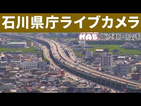
Shift from salt water to station architecture on the Kanazawa Station cam, compare inland refinement at Kenrokuen Garden, or watch city-scale weather from the Ishikawa Prefectural Office view.
Frequently Asked Questions
Does Kanazawa Port receive cruise ships?
Yes. The 2020 cruise terminal actively hosts international and domestic calls, especially in warmer months. Ship days are the most dramatic viewing.
Can I see Kenroku-en from this camera?
No. Kenroku-en sits inland. This view is the working harbor and river mouths — complementary, not interchangeable.
What rivers appear in the view?
The Ono River and Sai River are the main waterways feeding the port complex.
Is the stream live 24/7?
Availability depends on the source maintainer. Treat intermittent offline periods as normal for municipal harbor feeds.
How far is the port from Kanazawa Station?
Roughly 6–8 km by road; 20–30 minutes by bus or taxi depending on traffic and exact pier.
Why was this port built inland by excavation?
Excavation created protected berths and addressed soft coastal ground, while keeping deep-water access — a major mid-century infrastructure bet for Ishikawa.