Eastern Hokkaido does not rush. Tokachi–Obihiro Airport (とかち帯広空港) — IATA OBO, ICAO RJCB — sits on the Tokachi Plain roughly 25 kilometres south of downtown Obihiro, and this live camera treats the airfield as what it really is: a working regional airport where 737-class jets lift sugar-beet country into Tokyo’s orbit. When snow lies flat on the apron and a JAL or ANA narrowbody turns toward Runway 17/35, you are watching the Tokachi subprefecture exhale — agriculture, tourism, and business tied to a 2,500-metre strip that replaced a cramped military-era field in 1981.
About This Live Camera
The stream is operated by Kachimai (十勝毎日新聞 — Tokachi Mainichi Shimbun), Obihiro’s local newspaper, from a fixed position on or near the terminal building looking toward the apron and runway. YouTube video IDXRscHtp2s resolves the catalog’s previously empty embed — verify if playback fails, as channel live sessions can rotate. When live, expect near-real-time views of parked aircraft, pushback tug choreography, de-icing activity in winter, and weather moving across one of Japan’s coldest inland basins.
This is not Haneda density. OBO runs multiple daily services to Tokyo Haneda via JAL, ANA, and Air Do, plus seasonal international routes (such as Aero K services toward Cheongju, Korea, on limited schedules). Most movements you catch will be domestic narrowbodies — the aviation backbone of a region that feeds Japan.
Treat 24/7 claims cautiously: maintenance, connectivity, and YouTube policy interruptions happen. Refresh if the frame freezes; the Kachimai live camera portal (kachimai.jp/livecamera/) is the operator’s home base.
What You Can See
Runway 17/35 dominates the long view — 2,500 m of asphalt handling Boeing 737 and Airbus A320-family traffic. Apron activity includes boarding bridges, belt loaders, and winter snow-clearing vehicles that define Hokkaido airport life from November through March.
Aircraft liveries rotate through JAL, ANA, and Air Do — study tail colours and fuselage titles if you are learning Japanese domestic operators. Ground vehicles — buses linking terminal to city, fuel trucks, baggage carts — move at the unhurried pace of regional airports.
Weather is half the show: summer cumulus stacked over the Tokachi Plain, autumn crispness after harvest, winter ground blizzards that delay departures, spring melt with muddy access roads visible at frame edges. Night operations show ** apron floodlighting** and fewer movements — OBO is not a midnight freight hub like Narita.
On exceptional clear days, distant Hidaka Mountains may edge the horizon — not guaranteed from apron angle but worth watching for.
Location
The airport lies in Izumichō (泉町), Obihiro City, Hokkaido — coordinates near 42.731°N, 143.206°E, elevation ~150 m (490 ft). It serves Tokachi subprefecture (~340,000 people across eastern Hokkaido) and the city of Obihiro (~170,000).
Obihiro Station on the Nemuro Main Line sits ~25 km north — roughly 40 minutes by car or ~70 minutes by airport bus. The Doto Expressway and Obihiro-Hiroo Expressway link motorists via Kofuku Interchange, about five minutes from the terminal. Free parking is a regional perk compared to Tokyo airport tariffs.
Beyond the fence: infinite Tokachi Plain — sugar beet, beans, potatoes, dairy, and Tokachi beef country. Obihiro markets itself as Japan’s food valley; the airport exports people and imports Tokyo schedules.
History
Aviation here is a story of two airfields. The original Obihiro Airport opened 1960 on what is now Tokachi Airfield (十勝飛行場) — a JGSDF facility with roots in 1937 naval aviation. Civil use ended February 1981 when Tokachi–Obihiro Airport opened March 1981 with a 2,000 m runway. Extension to 2,500 m followed November 1985, enabling jet service growth.
The old field still operates for military and general aviation — a ghost sibling you will not see on this cam but important to local lore. Hokkaido Airports operates OBO; management moved toward private-sector outsourcing in 2021, part of a national trend.
Obihiro itself was pioneered by the Banseisha settlement group led by Benzo Yoda (1883), became a city 1933, and grew as Tokachi’s administrative and agricultural capital. The airport is young compared to the plain’s farming history — yet it now defines how Tokyo reaches beet country in ~100 minutes of flight time.
Why Watch
Because regional Japanese aviation is underrated television — no slot auctions, no A380 drama, just honest 737 rotations and snow plough ballet.
Because Hokkaido weather literacy starts at airports — if OBO shows blizzard whiteout, assume JR Hokkaido and highway ripple effects across Tokachi.
Because plane spotters can log Air Do and JAL/ANA regional liveries without Tokyo crowd noise.
Because Tokachi is food culture — watching arrivals helps you imagine Butadon pork bowls and Tokachi cheese riding the same jets you see taxiing.
Daily Life
Morning: first Haneda-bound departures, commuters, tour groups heading south. Midday: quieter apron — maintenance windows, occasional seasonal charter. Afternoon: return waves from Tokyo, business travellers, weekend tourists. Evening: last departures, ground crew securing equipment against wind. Winter nights: de-icing prep, fewer movements, dramatic lamp glow on snow.
Ground staff know regulars. Airport buses sync loosely with flight banks. Taxi to Obihiro Station costs roughly ¥7,000 — a reminder that distance on the plain is measured honestly.
Best Time of Day
- Morning departure banks: highest aircraft movement density.
- Clear winter midday: sharp light on snow and fuselages.
- Late afternoon: return traffic from Haneda; golden plain light.
- Before typhoon/extra-tropical systems: dramatic cloud walls — travel caution warranted.
Best Seasons
Winter (Dec–Mar): snow operations, de-icing, occasional delays — most cinematic for Hokkaido character. Spring: melt, muddy fields, migrating birds sometimes visible. Summer: green plain, festival travel peaks, heat haze. Autumn: harvest season energy, crisp visibility — favourite for photographers.
Events
Obihiro agricultural fairs and livestock expos increase passenger loads in summer and autumn. Snow festivals regionally (Sapporo dominates, but Tokachi hosts winter events) bump weekend traffic. Marathon and cycling events on the plain bring athletic delegations through OBO.
When JAL/ANA announce timetable revisions or Golden Week capacity changes, this camera shows whether the apron looks busier than usual — a crude but fun metric.
Getting There
Air: irony noted — you may already be here. Rail: Limited express Ōzora / Tokachi from Sapporo (~3 hours) to Obihiro Station, then bus or taxi. Car: Doto Expressway network — driving Hokkaido winter requires snow tires or chains by law in season. Bus: airport–station links timed to major flights.
Terminal facilities include domestic gates for JAL/ANA/Air Do, seasonal international processing, coin lockers, nursing rooms, and Tokachi souvenir shops pushing cheese and ** sweets**.
Interesting Facts
- IATA OBO / ICAO RJCB; nicknamed Tokachi–Obihiro Airport.
- Opened March 1981; runway extended to 2,500 m in 1985.
- Former Obihiro Airport site is now Tokachi Airfield (RJCT) — JGSDF operated.
- Primary scheduled route: Tokyo Haneda — JAL, ANA, Air Do.
- ~13.5 NM (25 km) south of Obihiro Station.
- Free parking at the terminal — unusual among Japan’s major airports.
- Obihiro is famous for Butadon (pork rice bowl) and Tokachi agricultural branding.
- Flight time to Haneda roughly 1 hour 40 minutes.
Apron Weather as Tokachi Forecast
Airport cameras are meteorology for people who distrust apps. Watch wind sock behaviour if visible, cloud base toward the Hidaka direction, and snow intensity on runway edges. Tokachi’s continental climate hits harder than Sapporo’s coast — -20°C mornings are routine in deep winter.
When the apron clears after a squall, expect taxi delays — ground crews prioritize safety over slot pride. Spring wind lifts dust from construction zones; summer heat shimmer wiggles distant hangar lines.
Agriculture in the Sky
Every 737 you see carries economic weight: executives from Tokyo visiting dairy cooperatives, farmers’ kids flying to university, chefs sourcing Tokachi beef, and tourists heading to Biei or Furano via Obihiro as a quieter entry than Asahikawa. The airport is small, but the plain it serves is among Japan’s most productive — sugar beet history shaped the entire subprefecture.
Pair this watch with Obihiro Railway Station to see how rail and air divide Tokachi mobility — train for plain distances, plane for Honshu speed.
Nearby Live Cameras
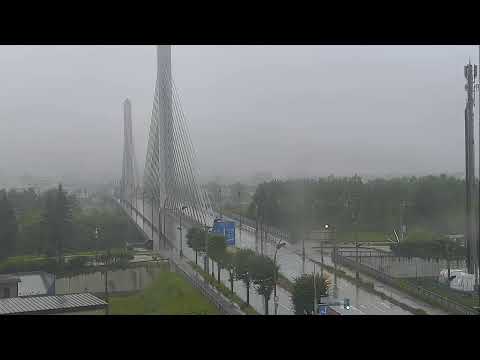
Continue exploring Tokachi with Obihiro Railway Station, Tokachi Ohashi Bridge, and Tokachichuoo Bridge — rail, river, and urban geography around the same plain.
Frequently Asked Questions
What airport code is Tokachi–Obihiro?
OBO (IATA) and RJCB (ICAO). Locals say Obihiro Airport or Tokachi–Obihiro Airport interchangeably.
Which airlines fly from OBO?
Scheduled domestic service to Tokyo Haneda via JAL, ANA, and Air Do. Seasonal international flights (e.g., Aero K to Korea) operate on limited schedules — check current timetables.
How far is the airport from Obihiro Station?
About 25 km (15.5 mi) south — ~40 minutes by car, ~70 minutes by airport bus, or ~¥7,000 by taxi.
Does this camera show all runways?
The Kachimai feed focuses on apron and runway from the terminal direction — not every taxiway angle, but enough for movements and weather.
Why was youtubeVideoId empty before?
The WebcamTaxi source catalog lacked an embed ID. The verified operator stream is IDXRscHtp2s on the Kachimai YouTube channel — re-check if playback fails.
Is the airport open 24 hours?
Passenger terminal hours follow flight banks; the live stream may run continuously but airside activity peaks around scheduled departures and arrivals.
What happened to the old Obihiro Airport?
Civil operations moved to OBO in 1981. The former site is Tokachi Airfield, used by the Japan Ground Self-Defense Force.
Can I see Mount Fuji from here?
No — wrong island, wrong direction. On clear days you may see Hidaka or plain horizons, not Fuji.