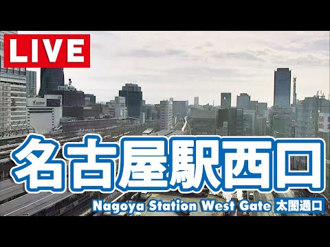
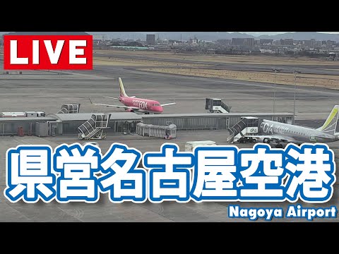
Nagoya’s skyline is often described through Nagoya Station towers and the industrial plain beyond — but some of the city’s most interesting urban drama happens a ten-minute walk south, where a canal, an expressway viaduct, and a brand-new campus district stack into one frame. The Sasashima Live Cam streams from Aichi University’s Nagoya Campus, looking across the Nagoya Expressway (C1) and the Nakagawa Canal toward the low-rise sprawl of Nakagawa Ward and the port-side geometry of Minato Ward. It is not a postcard camera; it is a working view of how Chūkyō moves freight, students, and commuter traffic through a corridor that did not exist in this form twenty years ago.
About This Live Camera
The feed is mounted at Aichi University’s Nagoya Campus in the Sasashima Live (ささしまライブ) redevelopment zone — a city-led project south of Meieki aimed at international exchange, hospitality, and waterfront activation. From the university’s vantage, the camera sweeps the Nagoya Expressway viaduct carrying the C1 Nagoya Urban Expressway loop, the tree-lined Nakagawa Canal below, and distant residential and commercial blocks stretching toward the Port of Nagoya.
Stream availability follows the YouTube source (video ID 822Uf8VdxsA); treat intermittent downtime as normal for third-party civic feeds. When live, expect HD clarity adequate for reading weather haze, rush-hour headlight rivers, and seasonal foliage along the canal embankment. The angle prioritizes traffic flow and horizontal city depth rather than close-up architecture — a deliberate contrast with Nagoya Railway Station platform drama or West Gate Nagoya Station street-level Shinkansen glimpses.
What You Can See
Expressway traffic dominates the foreground: cars, trucks, and occasional maintenance vehicles on the elevated C1 span. Lane density spikes weekday mornings and evenings when Meieki-bound commuters use the loop as a feeder. Canal water reflects sky color — grey in overcast tsuyu, silver in winter sun, green-gold when cherry trees along the towpath leaf out.
Beyond the viaduct, Nakagawa Ward rooftops and mid-rise apartments fill the middle ground. On clear days you may distinguish industrial silhouettes toward Minato Ward and port infrastructure — cranes and warehouse blocks too distant for detail but visible as horizontal texture. Night views turn the expressway into a continuous light ribbon; canal-side paths dim to sodium pools while distant office towers pinprick the horizon.
Rain is visually rich here: wipers on the lens are rare, but windshield spray from below, wet asphalt glare, and low cloud bases compress the scene into moody Chūkyō atmosphere.
Location
Sasashima Live sits in Nakamura-ku, Nagoya, Aichi Prefecture — roughly 600 m south of Nagoya Station as the crow flies, closer to Sasashima-raibu Station on the Aonami Line (AN02). The camera coordinates (35.161°N, 136.882°E) place it within the campus cluster at Hiraike-chō, part of the broader Nakagawa Canal landscape that links inland Nagoya to the port.
Geographically, you are in the Chūkyō metropolitan area (~10 million people), on Honshu’s Pacific side, between Tokyo and Osaka on the Tokaido Shinkansen corridor. Chubu Centrair International Airport (NGO) lies ~35 km south across the bay; Komaki Airfield (NKM) sits northwest. The canal itself once carried cargo barges; today it supports water-bus sightseeing and urban cooling along a revived waterfront promenade.
History
The Nakagawa Canal dates to Meiji-era port modernization when Nagoya expanded as a treaty-port industrial hub. Warehouses, timber yards, and rail spurs lined the waterway through much of the twentieth century. By the 1990s, the south-of-station strip was underused — a classic Japanese “waterfront waiting for a plan” problem.
Sasashima Live emerged from Nagoya City planning to reposition the Nagoya Station district as an international gateway ahead of Chubu Centrair opening (2005) and anticipated Linear Chuo Shinkansen service (2027 target). Aichi University opened its Nagoya Campus here in 2012, choosing the district because its development philosophy aligned with the university’s global-exchange mission. A 2015 partnership agreement with the city’s Housing and Urban Planning Bureau formalized community co-development; phase-two campus construction finished March 2017, and the Sasashima Live district celebrated its October 2017 “town opening.”
The Nagoya Expressway C1 loop — part of the Shuto-style urban expressway network — postdates much canal heritage but now defines the camera’s foreground. Aonami Line opening (2010) connected Kinjō-futō (Port of Nagoya / Legoland Japan access) to Meieki via Sasashima, stitching tourism and education into the same corridor the webcam watches.
Why Watch
Because this is Nagoya without the brochure — expressway realism, canal calm, and ward-scale sprawl in one static wide shot. Because Sasashima Live is the newest urban layer in a city that prefers engineering over ornament, and the camera lets you observe that layer before guidebooks catch up. Because weather and commute cycles read clearly: typhoon cloud banks, summer heat shimmer above asphalt, Golden Week traffic thinning to holiday quiet.
Compare with Nagoya Railway Station for rail pulse and Nagoya Airport Cam for aviation — Sasashima completes a Chūkyō mobility triangle from road, rail, and air perspectives.
Daily Life
Aichi University students cross the campus sky bridge between lecture halls while delivery trucks rumble the expressway below — two speeds of Nagoya in one glance. Commuters walking from Sasashima-raibu to Meieki share canal paths with joggers and water-bus tourists in warmer months. Office workers from Nakamura-ku convenience stores appear at lunch on embankment benches when the wind off the canal cuts summer humidity.
Port-bound logistics still matter: you will not see container ships from this elevation, but the camera’s sightline toward Minato Ward reminds you that Nagoya remains Japan’s largest port by tonnage — cars, machinery, and ceramics export through a harbor ecosystem this canal once fed directly.
Best Time of Day
- 07:00–09:00: weekday inbound expressway congestion; cool light in winter
- 12:00–14:00: calmer traffic; good for canal reflection photography via screen capture
- 17:00–19:00: outbound commute swell; headlights at dusk in autumn
- 22:00–05:00: sparse traffic; expressway becomes a lit sculpture; student study hours quiet the campus foreground
Sunrise east of the frame can pink-cloud the bay-direction haze; sunset backlights viaduct pillars dramatically in December clear-air days.
Best Seasons
Spring (March–April): canal cherry plantings and clearer Mount Ontake-direction visibility on lucky days — rare but memorable. Rainy season (June–July): low clouds, heavy rain streaks, true Nagoya humidity visible as atmospheric mush. Summer: heat haze and typhoon approaches — watch cloud walls march from the Pacific. Autumn: crisp visibility and golden embankment foliage. Winter: dry cold brings sharpest long-distance rooftop reading; occasional light snow dusts expressway barriers.
Events
Nagoya Matsuri (October) increases Meieki-area foot traffic indirectly — expect parking and peripheral road pressure visible as longer expressway queues. World Cosplay Summit weekends fill trains at Sasashima-raibu; the camera may not show costumes but may show elevated traffic. Legoland Japan holiday peaks ripple through Aonami Line connectivity — families route via Sasashima when staying south of Meieki.
University open-campus days and graduation season (March) add pedestrian clusters on campus-adjacent sidewalks below the frame edge. Typhoon landfalls on the Tokai coast produce hours of empty-looking expressways followed by sudden recovery surges — a logistics rhythm worth monitoring live.
Getting There
Sasashima-raibu Station (Aonami Line, AN02) is the nearest rail stop — ~2 minutes’ walk to the campus district. From Nagoya Station, walk south ~10 minutes along the Sasashima Live promenade or ride one Aonami stop from Kinjō-futō direction.
By car, the C1 Nagoya Expressway loops past the camera view; surface access uses Route 1 and canal-side roads from Nakamura-ku. Centrair travelers often reach Meieki by Meitetsu μ-SKY, then walk or transfer Aonami. Water-bus services on the Nakagawa Canal offer a slower, tourist-oriented approach from port-side attractions.
Interesting Facts
- Sasashima Live is marketed as Nagoya’s international welcome hub — multilingual signage and convention facilities target MICE tourism.
- Aichi University’s Nagoya Campus Sky Lounge (upper floors) offers curated canal views — the public webcam shares a similar axis at lower elevation.
- The Nagoya Expressway C1 is part of a ~228 km urban expressway network serving Greater Nagoya — viaduct engineering defines the camera foreground.
- Nakagawa Canal revival includes illumination events and cruise boats — water reflections the camera catches on calm evenings.
- Nagoya Station remains among the world’s largest station complexes by floor area — Sasashima extends that gravity southward rather than competing with it.
- Linear Chuo Shinkansen planning positions Nagoya as a maglev node — Sasashima development anticipates increased international footfall.
- Minato Ward hosts Toyota export docks and the Port of Nagoya Public Aquarium — economic cousins to the canal system below the frame.
- The source catalog once misstated Nagoya Station at 410 square metres; the real figure is on the order of 410,000 m² — a reminder to verify legacy webcam copy.
Canal and Expressway in One Frame
Urban Japan often separates water heritage from automotive present — here they collide. The Nakagawa Canal represents Edo-to-Meiji logistics reimagined for leisure; the C1 viaduct represents postwar car-capacity planning that reshaped every Tokai city. Watching both in one live shot teaches how Nagoya negotiates legacy infrastructure: neither demolished wholesale, neither sentimentalized — simply stacked.
When canal boats pass (visible as slow-moving dark shapes on water), contrast their pace with expressway speed differential — a lesson in Japanese urban time scales.
Reading Traffic as Weather Proxy
Without a dedicated meteorology overlay, expressway density becomes a social barometer. Golden Week outbound Friday queues, Obon mid-week lulls, Monday post-rain surges — patterns emerge for repeat viewers. Golden-hour glare on wet pavement after summer storms signals road-spray risk the same way aviation cams show crosswind drift.
Typhoon days often show empty lanes hours before news tickers explain highway closure protocols — the camera as early-warning aesthetic.
Nearby Live Cameras
Pair Sasashima’s road-and-canal horizon with Nagoya Railway Station for 4K rail theater, West Gate Nagoya Station for Taikō-dōri street and Shinkansen glimpses, and Nagoya Airport Cam for Komaki Airfield regional traffic.
Frequently Asked Questions
Where exactly is the Sasashima Live Cam mounted?
On Aichi University’s Nagoya Campus in the Sasashima Live district of Nakamura-ku, Nagoya, overlooking the Nagoya Expressway and Nakagawa Canal.
What expressway appears in the foreground?
The elevated C1 Nagoya Urban Expressway loop — part of the Greater Nagoya expressway network.
Is Sasashima the same as Nagoya Station?
No. Sasashima Live lies about 10 minutes’ walk south of Nagoya Station (Meieki); the nearest dedicated stop is Sasashima-raibu on the Aonami Line.
Can I see Nagoya Castle from this camera?
Unlikely — the angle favors canal, expressway, and ward rooftops toward Nakagawa and Minato; castle views require other vantage points closer to Naka Ward.
Does the stream run 24/7?
The source is YouTube-based; treat 24/7 as aspirational. Verify the player — maintenance and upstream resets happen.
How does this differ from Nagoya Railway Station cam?
Meieki cams focus on trains and station architecture; Sasashima emphasizes expressway traffic, canal waterfront, and south-of-station redevelopment.
What is Sasashima Live?
A Nagoya City waterfront redevelopment branding the area south of Meieki as an international exchange and hospitality hub, anchored partly by Aichi University’s campus since 2012.