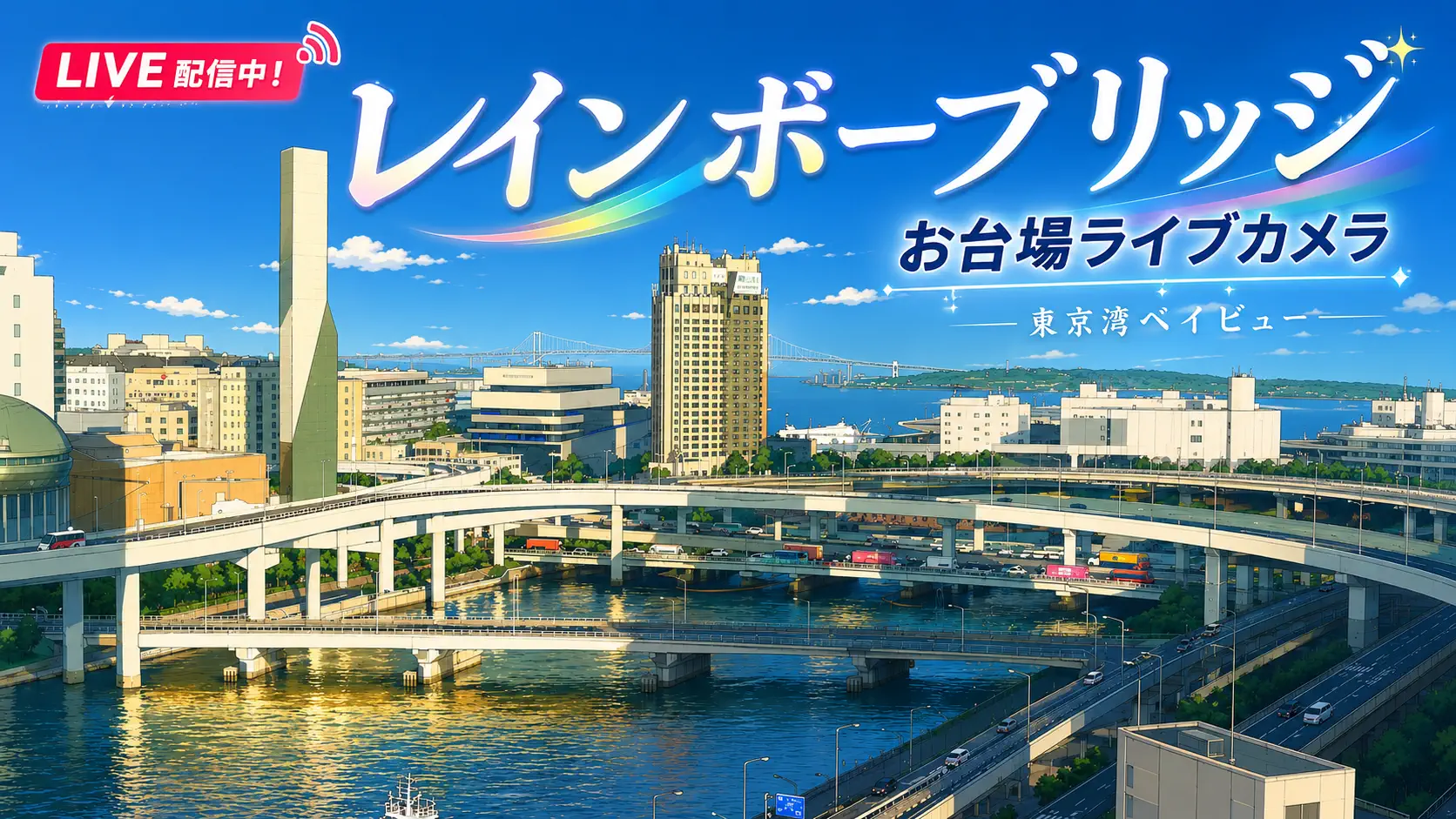
Tokyo has two competing skylines — the one you photograph and the one you commute through. This 4K waterfront panorama chooses the commute skyline and makes it beautiful anyway. Mounted on Odaiba in Minato Ward, the camera looks northwest across Tokyo Bay toward Rainbow Bridge, the Shibaura waterfront, and the layered towers of central Tokyo. It is not the Tokyo Tower close-up cam (red lattice in Shiba-koen) and not the Tokyo Skytree feed (634 m tower in Sumida). It is bay-scale — looped expressway ramps, suspension cables, ferries, and the slow theatre of Minato meeting the water.
About This Live Camera
YouTube stream _k-5U7IeK8g delivers a wide 4K panorama marketed as Tokyo Waterfront Cityscape. The framing centres Rainbow Bridge (レインボーブリッジ) — official name Shuto Expressway No. 11 Daiba Route – Port of Tokyo Connector Bridge — with its characteristic looped Shuto Expressway ramp curling into the span. Gentle background music often accompanies the feed, making it closer to ambient waterfront TV than a raw traffic cam.
Coordinates (~35.632°N, 139.750°E) sit on the artificial island side of the bay — the Odaiba / Daiba reclaimed-land district — not on the bridge itself. When live, you get day-night traffic flow, Yurikamome lower-deck glints if angle permits, ferry and harbour traffic, and weather systems crossing Tokyo Bay.
Treat 24/7 as aspirational — typhoons, platform maintenance, and YouTube resets interrupt any bay cam. Refresh if the player stalls. This stream complements but does not duplicate Rainbow Bridge, Odaiba — compare both if you want alternate crops of the same landmark.
What You Can See
Rainbow Bridge dominates: 798 m total length, 570 m main span, 126 m towers, opened 26 August 1993. By day, upper-deck expressway traffic streams between Shibaura and Odaiba; by night, LED illumination cycles white, green, and coral pink on cables with seasonal tower whites (cool April–October, warm November–March).
Looped roadway in foreground belongs to the Shuto Expressway — hypnotic arc geometry busy with commuters. Lower deck carries Yurikamome automated transit, Route 482, and pedestrian walkways (Rainbow Promenade) invisible as detail but implied by bridge design.
Tokyo Bay traffic: ferries, water buses, cargo craft, occasional yakatabune houseboats farther east depending on crop. Water colour shifts from summer haze grey-blue to post-typhoon navy.
Distant skyline: Minato and Chūō towers — on clear frames you may glimpse Tokyo Tower’s red silhouette right of centre (unlike Skytree, which lies northeast and rarely dominates this west-facing bay view). Mt. Tsukuba (筑波山) sometimes appears inland on winter clarity days — a natural bookmark reminding you Tokyo sits on the Kantō Plain, not an island alone.
Sunsets paint the bay gold; night turns the loop and bridge into a jewellery display.
Location
Odaiba sits in Tokyo Bay as part of Minato Ward’s Rinkai Fukutoshin (“secondary centre”) — landfill islands born from Edo-era batteries, Meiji industry, and 1990s–2000s waterfront redevelopment. The camera looks toward Shibaura Pier and central Tokyo, not toward Yokohama or Haneda (though Haneda approaches cross bay airspace outside this frame).
Nearby on Odaiba: Odaiba Marine Park, Daiba Park, teamLab venues, DiverCity (Gundam), Aqua City, Tokyo Big Sight convention halls, Statue of Liberty replica — postcard Japan with infrastructure soul.
Across the bridge: Shibaura island district, Shuto Expressway tentacles, Takeshiba ferry terminals. The panorama encodes 1990s bubble-era optimism — white bridge chosen to harmonize with central Tokyo when viewed from the bay.
History
Tokyo Bay reclamation shaped this view. Third Tokyo Bay Fortress batteries (1853–1856) once sat where malls now glow. Postwar industrial zones gave way to 1980s–90s visions of a waterfront subcentre — partially delayed by bubble collapse but never abandoned.
Rainbow Bridge construction 1987–1993 by Kawasaki Heavy Industries linked Odaiba dreams to Shibaura reality. The English name won a public vote; bureaucrats kept the longer expressway title for documents. Yurikamome opened 1995, making the lower deck feel futuristic. Illumination was designed from the start — among early three-colour timed cable schemes; LED retrofit 2020 cut power demand while preserving aesthetics. Solar contribution feeds night lighting narratives operator materials promote.
Odaiba continued evolving: Palette Town demolition, tourism spikes, Marine Day crowds, Olympic-era infrastructure polish — yet the bridge remains the constant horizon line this cam returns to.
Haneda Airport (HND) lies southwest across the bay — you may spot approach paths as tiny aircraft if the crop and weather align, though this feed prioritises bridge geometry over aviation spotting. Pair with Haneda Airport for dedicated runway watching.
Why Watch
Because Tokyo at scale beats Tokyo in close-up — bay perspective teaches how Minato, Chūō, and Shibaura relate spatially.
Because sunset → night here is a free light show — looped ramps plus Rainbow Bridge LEDs.
Because weather tracking for bay events — if this cam grey-outs, reconsider Haneda plans and waterfront walks.
Because it pairs logically with Tokyo Tower View (landmark close-up southwest) and Tokyo Skytree (east-side tower cam) — three different focal lengths on one metropolis.
Daily Life
Morning: expressway commute ribbons, joggers on Marine Park paths. Daytime: tourists, Yurikamome sightseers, Big Sight conference migrations. Evening: date-night waterfront walks, illumination switch-on (~30 minutes after sunset until midnight, schedule varies). Late night: thinning traffic, maintenance vehicles, occasional film crews.
Weekends amplify leisure loops — rental cars circling Odaiba for bridge photos. Ferries increase on holidays. Music on the stream softens the industrial honesty — unusual for traffic cams, deliberate here.
Best Time of Day
- Sunset through midnight: illumination onset and peak bay colour.
- Clear winter morning: Mt. Tsukuba and sharp skyline separation.
- Post-rain: cleaned air, reflective bay surface.
- Typhoon approach (indoors only): dramatic cloud — do not travel to watch.
Best Seasons
Winter: clearest long sightlines. Spring: comfortable waterfront hours; occasional mist. Summer: humid haze — moody, softer distances. Autumn: typhoon season drama. Year-end holidays: special rainbow lighting programs possible — watch operator announcements.
Events
New Year and Christmas often trigger enhanced Rainbow Bridge sequences. Tokyo Bay fireworks (when scheduled) may appear as distant pulses — audio rarely reaches the stream. Odaiba hosts Gundam unveilings, triathlon, outdoor markets — pedestrian energy rises even if bridge traffic looks unchanged.
Marine Day (third Monday in July) brings yukata crowds. Convention weeks at Big Sight stack hotels and Yurikamome queues.
Getting There
Yurikamome: Daiba or Odaiba-Kaihinkoen stations — walk Rainbow Promenade when open (closed in typhoon winds — check notices). Rinkai Line: Tokyo Teleport station. Bus and taxi access via Rainbow Bridge upper deck toll road — no stopping for photos.
Remote viewers: this page is the promenade without wind chill.
Interesting Facts
- Rainbow Bridge length 798 m; main span 570 m; towers 126 m.
- Opened 26 August 1993; builder Kawasaki Heavy Industries.
- English name chosen by public submission; night lighting includes rainbow modes on special dates.
- Lower deck: Yurikamome, Route 482, pedestrian Rainbow Promenade.
- LED upgrade completed 2020; solar assists illumination power story.
- Camera sits on Odaiba, Minato Ward — not Chiyoda or Sumida.
- Tokyo Tower may appear distantly; Skytree is outside typical west-facing bay sightlines.
- Stream includes ambient music — rare among infrastructure feeds.
Three Tokyo Cameras, Three Vantages
Confusion is common — clarify your watch:
| Camera | Where it looks | Hero landmark |
|---|---|---|
| This panorama | Odaiba → Shibaura | Rainbow Bridge + bay |
| Tokyo Tower View | Shiba-koen | Tokyo Tower close-up |
| Tokyo Skytree | Sumida riverside | Skytree tower |
Use all three before claiming you’ve “seen Tokyo on webcam.”
Bay Light as Mood Ring
Morning silver on the loop means clear Kantō high pressure. Flat grey with visible Rainbow Bridge towers but no distant mountains means summer humidity or pollution haze. Violent purple clouds with steady traffic means typhoon outer band — fascinating, not invitation.
When ferries disappear from frame entirely, check whether bay wind closed small-craft operations — a subtle operational signal.
Yurikamome front-car views made the lower deck famous in travel blogs; this panorama shows the upper deck arc those trains cannot see — complementary perspectives on the same 1993 engineering object. Watch long enough and you learn expressway rhythm: steady weekday pulse, Golden Week stutter, Obon leisure loops.
Nearby Live Cameras
Deepen the waterfront set with Rainbow Bridge, Odaiba, Tokyo Bay, Odaiba, and Tokyo Tower View for landmark contrast.
Frequently Asked Questions
Is this camera on Rainbow Bridge?
No — it films from Odaiba toward the bridge and Shibaura — you are on the island side.
Does this show Tokyo Skytree?
Usually not prominently — this west-facing bay panorama favours Rainbow Bridge and Minato skyline. Use Tokyo Skytree for the 634 m tower.
Why is the city listed as Minato?
The camera sits on Odaiba, part of Minato Ward, Tokyo — not Chiyoda (central government district) despite distant views toward central Tokyo.
When do bridge lights turn on?
Roughly 30 minutes after sunset until midnight — seasonal adjustments apply.
Is the stream truly 4K?
The source is marketed as 4K; actual YouTube playback quality depends on your device and bandwidth.
Why is there music?
The operator adds ambient background music — part of the feed’s relaxed waterfront branding.
Can I see Mount Fuji?
Fuji is west and often obscured by haze from this angle. Mt. Tsukuba inland is the more common clear-day bonus.
How is this different from Odaiba Rainbow Bridge cam?
Both are Odaiba-side bay views — crops and operators may differ. Compare Rainbow Bridge, Odaiba for an alternate framing of the same landmark.