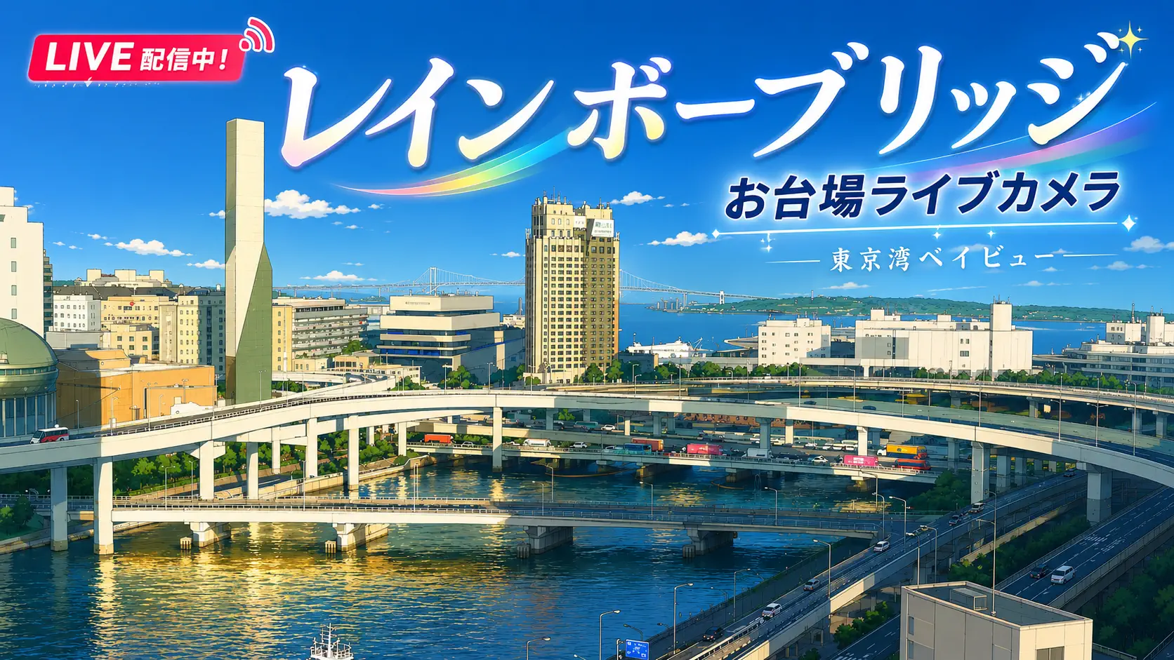
Tokyo Bay is where the capital learned to float. Odaiba — a chain of reclaimed islands stitched together over more than a century — sits in Minato Ward facing the open water, and this HD live camera treats the bay as the main character. Sightseeing ferries cross paths with cargo logic. A Rainbow Bridge silhouette anchors the frame when the angle allows. Traditional yakatabune houseboats drift past glass towers that did not exist when the first cannon batteries were poured here in the 1850s. And because Haneda Airport lies just across the water, aircraft sometimes slide through the sky as casually as boats through the channel. It is waterfront television with no narrator — only movement, weather, and one of the world’s busiest harbours breathing in real time.
About This Live Camera
The stream comes from the Odaiba / Tokyo Bay vantage associated with EN DAIBA and similar waterfront broadcasters — a fixed or lightly adjusted HD view over Tokyo Bay from the island’s marina side. When live, you get a wide harbour panorama: water colour, vessel traffic, distant Minato and central Tokyo skyline fragments, bridge geometry, and the atmospheric stack that makes bay watching addictive. The feed is not a theme-park ride cam or a single-landmark pole; it is a working waterfront document.
Treat availability as intermittent rather than guaranteed 24/7. YouTube embeds can drop, swap angles, or pause during maintenance — refresh if the frame freezes. What remains reliable is the geography: Odaiba looks north and west toward central Tokyo across the bay, with Rainbow Bridge as the most recognizable fixed landmark when visibility cooperates.
What You Can See
Watercraft dominate the readable action. Tokyo Bay Live Cruise boats, water buses, and private yachts share lanes with working harbour traffic depending on hour and season. Yakatabune — low wooden party boats with lanterns and tatami seating — appear on many evenings, especially weekends, turning the bay into a floating restaurant district you can watch without a reservation.
Rainbow Bridge (opened 1993) spans roughly 800 metres between Shibaura and Odaiba when your angle includes it — white towers, suspension cables, and after dark a programmed light show that shifts by season and event calendar. On clear days you may pick out Tokyo Tower, Skytree hints, or the Fuji TV building’s distinctive architecture closer to the camera. A Statue of Liberty replica stands in Odaiba Marine Park — small by New York standards, beloved as a photo prop, sometimes visible depending on lens crop.
Haneda Airport (HND) approach paths cross the bay regularly. Watch for descending jets in late morning and afternoon banks, or climbing departures threading between clouds and cranes. Tokyo Gate Bridge farther east sometimes enters wider community feeds; this particular stream may or may not include it — do not treat it as guaranteed.
Weather reads honestly: summer haze softens everything; winter cold fronts carve sharp edges into the skyline; typhoon season brings grey rollers and cautious boat traffic; rain turns the bay mirror-dark and empty in a way that is its own mood.
Location
Geographically near 35.631°N, 139.768°E in Minato Ward, Tokyo. Odaiba is administratively split between Minato and Koto across its several sub-islands, but the classic tourist waterfront — Marine Park, Seaside Park, Decks, Aqua City — reads as Minato-facing bay culture.
The camera’s mental map:
- North / northwest: central Tokyo skyline across the bay
- West: Rainbow Bridge toward Shibaura and the Shuto Expressway bayshore ribbon
- South / east: open bay toward Haneda, Koto waterfront, and farther Chiba leisure coast
- Immediate foreground: Odaiba piers, promenades, and marina activity
Odaiba connects to the mainland via Rainbow Bridge (cars and the Yurikamome automated guideway) and via tunnels from Shibaura. The Yurikamome Line is itself a sightseeing experience — driverless trains curving over the bay — though the webcam shows its effect (people arriving) more than its rails.
History
Odaiba’s name comes from the daiba gun batteries Tokugawa Japan built in the 1850s to answer Western naval pressure — literal “platforms” for cannon facing the bay. After the Meiji era the military use faded, and reclamation accelerated through the twentieth century. What began as defensive infrastructure became land hungry Tokyo could not spare inland.
The bubble-era 1990s vision for Odaiba as a futuristic city-within-a-city produced mega-malls, hotel towers, and Rainbow Bridge as a deliberate symbol — white suspension engineering chosen to photograph well against grey water. Some bubble projects stalled; others matured into the mixed leisure-office district you see today. Telecom Center, Palette Town (with its Gundam statue era), teamLab venues, and convention halls at Tokyo Big Sight on adjacent Ariake fill out the “new Tokyo” story.
The bay itself carries older layers: Edo-period shipping, postwar industrial port growth, landfill for Haneda expansion, and the perpetual negotiation between harbour logistics and waterfront lifestyle. Odaiba’s camera catches the present compromise — tourists on decks, boats earning yen, planes still using bay airspace because cities do not move airports casually.
Why Watch
Because Tokyo is usually explained through crossings and towers, and this feed argues for water as the honest spine of the capital. Because Rainbow Bridge at blue hour is one of Japan’s great free shows, and you can watch it while cooking dinner elsewhere on the planet. Because comparing boat density here with aircraft density near Haneda teaches Tokyo scale faster than a transit map.
Remote viewers use the stream for weather checks before bay-side walks, for virtual travel during office breaks, and for ambient harbour soundscapes if audio is enabled on the source player. Locals sometimes leave it open during typhoon approach — less drama than Pacific coast surf cams, but real civilizational stakes when storm surge meets a low city.
Daily Life Around the Bay
Morning brings joggers on Odaiba Seaside Park paths and maintenance crews on piers. Midday shifts toward tourists — shopping complexes open, Ferris wheels spin at Palette Town when operating, cruise ticket queues form near marine terminals. Afternoon is prime boat traffic: water buses on schedule, private sails when wind cooperates.
Evening belongs to yakatabune lights and Rainbow Bridge illuminations. Office workers from Shiodome and Shinagawa sometimes detour here for date-night decks; families come for the Liberty replica photos and beach sand that is more symbolic than Caribbean. Weekends amplify everything — louder crowds, more ferries, longer waits at Yurikamome platforms visible only indirectly through human density on the waterfront.
Weekday versus holiday rhythm matters. A Tuesday might emphasize commuter-adjacent logistics and subdued leisure traffic; a Saturday reads like a festival floating on barges.
Best Time of Day to Watch
- Sunrise to mid-morning: softer light, fewer boats initially, clearer winter views
- Late afternoon: active cruise departures, warming colour on bridge towers
- Blue hour / early night: Rainbow Bridge lights, yakatabune lanterns, Haneda aircraft lights multiplying
- Post-rain clarity: when fronts pass, visibility can jump dramatically for skyline details
If you want aircraft, align with Haneda bank patterns — often busier mid-morning and mid-afternoon JST — and remember approach visibility varies with runway use and weather.
Best Seasons and Weather
Winter often delivers the crispest long sightlines across Tokyo Bay — cold dry air is a photographer’s friend. Spring brings comfortable promenade weather and occasional haze; cherry blossoms are more a mainland park story, though plums near waterfront plantings can appear. Summer is humid haze theatre — soft greys, sudden thunderstorms, spectacular cumulus towers after heat peaks. Typhoon season (roughly late summer–early autumn) can push dramatic seas or temporarily silence the feed if operators secure equipment.
Autumn can balance comfortable temperatures with mixed visibility — worth keeping open for sunset sessions when typhoons are not steering the week.
Events and Celebrations
New Year sunrise watchers gather on bay-facing decks — the camera sometimes catches early light crowds as specks. Marine Day and summer festival seasons increase boat decorations and fireworks elsewhere on the bay — not always in-frame, but ambient light changes can hint at celebrations. Rainbow Bridge light-ups shift for campaigns — check Tokyo waterfront news if you chase specific colour schemes.
Tokyo Big Sight convention seasons (Comiket-era crowds, trade shows) swell Yurikamome ridership even when the hall itself sits off-camera on Ariake. Odaiba Memorial Day fireworks historically featured bay displays — verify current schedules; fireworks may appear on sister cams when not here.
Corporate illumination battles among Odaiba malls intensify in December — indirect glow on low clouds can be visible from a distance.
Getting There
Yurikamome Line from Shimbashi or Shiodome to Daiba, Odaiba-Kaihinkoen, or Tokyo Teleport stations — scenic approach over the bay. Rinkai Line connects to Tokyo Teleport from Osaki direction. Buses serve major malls from central Tokyo.
On foot or bike: Rainbow Bridge has a pedestrian walkway on certain days and hours — verify current access rules before planning; it is not always open. Water buses from Hinode Sanbashi and other piers offer the view this camera inverts — looking back at Odaiba from the water.
For remote viewers, “getting there” means opening the stream before a trip to decide whether bay haze warrants a sunset plan or an indoor mall evening instead.
Interesting Facts
- Odaiba’s daiba roots are literal gun batteries from the 1850s — defence before shopping.
- Rainbow Bridge is about 798 metres between main pylons and opened in September 1993.
- The Statue of Liberty replica in Marine Park stands roughly 12–15 metres tall depending on pedestal measurement — a gift-era symbol, not ancient history.
- Haneda is among the world’s closest major airports to a city core — bay cams prove it visually.
- Yakatabune culture predates modern Odaiba — Edo-era pleasure boating echoes in today’s lit houseboats.
- Odaiba spans Minato and Koto — two wards, one leisure brand.
- Reclamation continues to shape Tokyo Bay geography elsewhere; Odaiba is the famous chapter, not the only one.
Harbour Rhythm: Reading the Water
Learn to read wake patterns: fast ferries leave V-shaped signatures; barges push slow rectangles; yakatabune drift with almost no urgency. Count vessel types in ten minutes and you have an informal economic index — tourism versus logistics versus private leisure.
Watch tide indirectly through ramp usage and exposed mud flats near some edges — not dramatic like Seto Inland Sea narrows, but real. Colour temperature shifts before weather fronts: green-grey water often precedes rain; deep blue after cold winds.
When planes appear, note altitude and gear — low gear over the bay means you are watching final approach storytelling; higher climb-outs are departures beginning their arc. Pair with a Haneda feed on another tab if aviation is your primary language.
Night Bay as Urban Poetry
Tokyo sells neon inland; Odaiba sells reflection. Bridge lights duplicate on ripples; yakatabune paper lanterns become soft orange pixels. Leave the stream open through blue hour when you want mood without Shibuya noise.
Nearby Live Cameras
Pair this bay panorama with Odaiba Rainbow Bridge for bridge-centric framing, Haneda Airport for aviation-over-bay context from the Koto side, and Tokyo Tower View when you want inland vertical Tokyo after horizontal water.
Frequently Asked Questions
Is this camera on Rainbow Bridge itself?
No — it is an Odaiba waterfront bay view that may include Rainbow Bridge in the distance depending on aim and crop, not a bridge-deck mount.
Can I see Haneda runways directly?
Usually not as ground detail — you see aircraft on approach or departure over the bay, not terminal gates.
What are yakatabune?
Traditional-style houseboats used for dining and sightseeing, often lit at night — a signature Tokyo Bay evening sight.
Is Odaiba one island?
It is a group of reclaimed islands linked together, administratively split between Minato and Koto wards.
When is visibility best?
Often winter mornings after cold fronts; summer can be hazy unless wind clears the bay.
Is the stream always live?
Treat it as intermittent — refresh if offline; operators may pause during storms or maintenance.