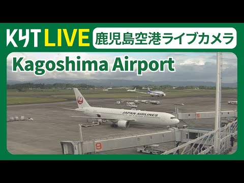
Kyushu’s northeast coast keeps a low profile until you need to fly. Oita Airport (OIT / RJFO) sits on a peninsula in Kunisaki City, not inside downtown Oita, and this live camera turns that geography into watchable rhythm: jets rolling a 2,000-metre runway, ground vehicles threading the apron, and beyond the fence the Seto Inland Sea glinting under Pacific light. It is a regional airport cam in the best sense — readable movements, honest weather, and enough daily departures that something usually happens without Narita-scale overwhelm.
About This Live Camera
The YouTube stream looks across Oita Airport from an elevated or perimeter angle that foregrounds runway and flight-line activity while keeping sea and hills in the background. When live, expect taxi, takeoff, landing, and gate-adjacent motion depending on wind and schedule — narrow-body domestic jets dominate, with occasional international arrivals from nearby Asian hubs.
Do not assume 24/7 reliability; regional airport feeds pause for maintenance, weather, or embed issues. Refresh if the frame stalls. The value is structural: a coastal Kyushu airfield where land, sea, and scheduled metal meet in one frame.
What You Can See
Runway operations are the headline. Oita’s runway (18/36, approximately 2,000 m) handles Boeing 737-class domestic traffic and similar narrow-bodies. Watch for All Nippon Airways, Japan Airlines, Solaseed Air, Jetstar Japan, and IBEX Airlines patterns — Tokyo banks, Osaka Itami (ITM) hops, Nagoya Chubu links.
International service is regional rather than intercontinental: routes have included Seoul Incheon, Taipei Taoyuan, Busan Gimhae, and Muan in Korea — verify current timetables seasonally. The old aggregator copy listing Los Angeles, Sydney, or Vancouver reflects historical or aspirational network phases, not today’s typical board.
Foreground ramp equipment — tugs, buses, belt loaders — tells ground-crew choreography. Background Seto Inland Sea horizons give scale: this is not an inland basin airport; storms track differently when ocean sits behind the fence.
General aviation and training movements occasionally appear — light jets, turboprops — plus rare excitement when special liveries or charter sports teams pass through tournament season.
Location
Near 33.481°N, 131.728°E in Kunisaki City, Oita Prefecture, on the Kunisaki Peninsula northeast of Oita City proper — roughly 30 km from the prefectural capital by road, shorter by the revived hovercraft link when operating.
Mental map:
- Airport occupies coastal flatland on the peninsula’s east side
- Oita City lies southwest across bay and mountain logic
- Beppu hot-spring city sits northwest along the coast — culturally paired with Oita tourism even though the airport is not in Beppu itself
- Seto Inland Sea stretches north and east toward Honshu
The webcam’s “Kunisaki, not Oita city” distinction matters for travelers: taxi times, hotel planning, and hovercraft schedules all reference two different places sharing one prefecture brand.
History
Aviation here began in the 1960s as regional Japan wired Kyushu into jet age domestic networks. Oita Airport opened to serve a prefecture known for onsen, agriculture, and heavy industry — steel, chemicals, and port logistics around Oita City and Beppu.
Runway extensions and terminal upgrades tracked growth in Tokyo and Osaka business ties. International experimentation came in waves — charter seasons, Asian LCC trials, cargo hopes — reflecting Oita’s ambition to punch above strict population math.
A memorable modern chapter: Virgin Orbit selected Oita as a proposed spaceport site before corporate bankruptcy shifted plans; prefectural officials continued exploring aerospace branding — including temporary Hello Kitty airport naming around 2025 Expo season — signaling how regional airports market identity beyond runways.
The hovercraft story loops history forward: an 1971–2009 service ended, then 2025 saw renewed passenger hovercraft linking airport and city after delays — a transport drama you feel when watching weather over water behind planes.
Why Watch
Because regional Japanese aviation is legible here — intervals you can follow, aircraft families you learn, weather that changes outcomes. Because the sea backdrop separates Oita visually from inland strips like Fukushima or Hanamaki. Because Oita watchers tracking onsen trips, rugby tours, or USJ-bound connections through Itami use live feeds as mood checks before packing.
Plane spotters appreciate coastal wind shifts and summer haze versus winter clarity. Remote viewers enjoy the Kyushu calm — not Tokyo frequency, not Kansai sprawl — a single-runway poem.
Daily Life Around the Airport
Kunisaki Peninsula life mixes farming, fishing, temple pilgrimage routes (Rokugo Manzan heritage), and airport service jobs. Morning departures align with business commuters and Tokyo meeting schedules; midday breathes; evening brings returns and family pickups at the small terminal.
Inside the terminal, local souvenir counters push kabosu citrus, shiitake, and Beppu onsen goods; cafés serve quick udon before boarding. Ground staff know repeat travelers — regional airports still feel human-scaled.
Hovercraft passengers when running add a harbour commute subplot — unusual enough to be worth watching timetables if you visit. Road buses link Oita Station, Beppu, and resort areas on clockwork if less cinematically.
Best Time of Day to Watch
- Morning departure banks (~7:00–10:00 JST): densest jet activity toward Tokyo and Osaka
- Afternoon returns (~15:00–19:00): inbound waves and turnaround choreography
- Clear midday: best sea visibility for photography grabs
- Windy days: interesting crosswind landing practice if visible from angle
International arrivals often cluster mid-afternoon — check weekly patterns rather than assuming hourly evenly spaced traffic.
Best Seasons and Weather
Winter can be startlingly clear — Seto Inland Sea blue, Fuji-distance thinking if you travel elsewhere. Spring brings mild haze and Golden Week peaks. Summer is humid with typhoon interruptions — airport closures happen regionally when storms track east of Kyushu; watch NOTAM culture indirectly via feed silence.
Autumn is comfortable spotting weather — stable winds, softer light. Year-end travel surges around Obon and New Year echo in frequency even if individual flights are not labeled on-screen.
Events and Celebrations
Golden Week and Obon expand passenger volume — more movements, fuller aprons. Sports tournaments (high school baseball nationals, corporate rugby) occasionally spike charter traffic. Hello Kitty rebranding periods and Expo-year tourism campaigns add marketing colour to terminal life even when the runway view stays plain asphalt.
Local Kunisaki festivals (peninsula shrine traditions) do not happen on the tarmac, but festival weekends shift leisure demand on Tokyo and Osaka routes — indirectly visible as fuller 737 loads.
Getting There
By air: obviously — but from Oita Airport outward. By road: buses to Oita, Beppu, and regional stops; rental cars common for onsen loops. By hovercraft: when service operates, roughly 35 minutes airport–city versus longer road times — verify current operator status before planning romance with the craft.
By rail: Oita Station on the JR Nippo Main Line is the prefecture’s rail hub; airport connection is road/hovercraft, not a single-seat train like some larger cities enjoy.
Remote viewers “get there” by watching first — if sea fog fills the frame, your Beppu sunset plan might need a hotel near the airport instead.
Interesting Facts
- IATA: OIT, ICAO: RJFO — serves Oita Prefecture, physically in Kunisaki City.
- Runway about 2,000 m — optimized for domestic narrow-bodies, not long-haul widebodies.
- Top destinations are Tokyo (Haneda/Narita), Osaka Itami, and Nagoya — the Japanese business triangle.
- International network focuses on East Asia hubs, not trans-Pacific daily service.
- Hovercraft returned in 2025 after a long hiatus — rare airport transport theatre.
- Prefecture explored spaceport branding after Virgin Orbit headlines — ambitious for a quiet peninsula.
- Average daily departures sit around roughly twenty in typical schedules — enough for live watching, not constant roar.
Runway Weather Literacy
Coastal airports teach crosswind intuition. Watch how aircraft crab on final — subtle angle changes mean breeze off the Seto Inland Sea. Summer heat shimmer lifts off asphalt and softens long-lens detail; after typhoon passage, insanely clear days reward patience.
Compare takeoff roll length by type — 737s versus smaller props — and you begin reading weight and wind without METAR charts. When the feed goes quiet midday, it is often schedule gap, not failure — regional airports breathe between banks.
Kyushu Gateway Perspective
Oita is not Fukuoka (FUK) — Japan’s busiest Kyushu hub sits hours west by shinkansen logic — but Oita matters for east Kyushu residents avoiding long surface transfers. Watching OIT explains why some travelers accept fewer frequencies for peninsula proximity and Beppu onsen access.
Pair mental model with Kagoshima south or Fukuoka north cams if you want a Kyushu aviation triangle — three different coast personalities in one afternoon tab stack.
Nearby Live Cameras
Continue Kyushu themes with Beppu Bay Cam for coastal road and channel weather near Oita City, Kyushu Fukuoka Airport for major-hub contrast, and Kagoshima Airport Cam for southern Kyushu’s volcanic horizon logic.
Frequently Asked Questions
Is Oita Airport inside Oita City?
No — it is in Kunisaki City on the Kunisaki Peninsula, northeast of downtown Oita.
Can I see international widebodies every hour?
No — service is primarily domestic jets plus select East Asian routes; do not expect constant long-haul traffic.
What is visible behind the runway?
The Seto Inland Sea and coastal hills — a signature backdrop for this cam.
How does this differ from Fukuoka Airport?
Fukuoka is a large urban hub; Oita is a smaller regional field serving east Kyushu and onsen country.
Is the hovercraft running?
Status has changed historically — verify current operator announcements before travel; service resumed in 2025 after a long gap.
Are Los Angeles or Sydney flights typical?
Not in current regular schedules — treat such claims in old guides as outdated; check the airport’s official timetable instead.