Water the colour of polished glass runs beneath a wooden suspension bridge, and beyond it the Hotaka range rises like a wall drawn by a patient hand. Kappa Bridge (河童橋) spans the Azusa River at the heart of Kamikōchi, a highland valley in the Hida Mountains—the northern Japanese Alps—administered within Matsumoto City, Nagano Prefecture. At roughly 1,500 metres elevation, the air feels sharper than in the city below; larch and willow lines the banks, and on clear mornings Mount Yake may show steam on the southern horizon. This live camera turns one of Japan’s most beloved alpine viewpoints into a window you can leave open while deciding whether this is the year you finally pack trail shoes and ride the bus up the valley.
About This Live Camera
The feed anchors on Kappa Bridge and the river corridor, with peaks framing the background when weather cooperates. It is a landscape camera first—pedestrian traffic appears seasonally rather than around the clock because Kamikōchi closes in winter. Stream availability may follow park operating months; outside the official season the valley shuts to routine tourism and the bridge area is largely dormant. When live, the view delivers slow cinema: cloud shadows crossing meadows, hikers crossing the span, morning mist lifting off cold water. Pair watching with official park status pages before planning travel—the camera informs mood, not access permits.
What You Can See
The 36.6-metre wooden suspension bridge itself—currently the fifth generation, rebuilt in 1997—is the focal point. Beneath it, the Azusa runs transparent enough to reveal river stones and, with luck, fish holding in eddies. Upstream and downstream trails thread through mixed forest; you may spot guided groups in colourful rain gear. Kamikōchi Bus Terminal and visitor facilities sit adjacent—this is the valley’s “main street,” sometimes nicknamed Kamikōchi Ginza at peak crowds. Mount Myōjin (2,931 m) and Mount Oku-Hotaka (3,190 m) dominate the skyline on clear days. Autumn brings gold larch and red rowan; spring shows snow patches on peaks while valley greenery returns.
Location
Kamikōchi lies in the upper Azusa River valley within Chūbu-Sangaku National Park, on Honshu’s main island. Administratively it belongs to Matsumoto—the castle town two hours downstream by rail and bus. Private cars are banned beyond designated parking areas; most visitors arrive by Alpico bus from Shin-Shimashima terminal (reached by Kamikōchi Line train from Matsumoto) or by direct buses from Matsumoto Bus Terminal and Takayama. The camera coordinates sit at the bridge cluster near Konashita and the central visitor zone—trailheads toward Myōjin Pond, Tokusawa, and Yokoo radiate from here.
History
Kamikōchi was logged through the 19th century until conservation advocates— notably Walter Weston, the British missionary-mountaineer—helped shift public opinion toward preservation. The Weston Festival each June honours that legacy. Kappa Bridge began as a drawbridge; it became a suspension bridge in 1910 and was rebuilt in 1930, 1957, 1975, and 1997. The name predates Ryūnosuke Akutagawa’s 1927 novella Kappa, but the book’s vivid portrait of the valley fixed the bridge in Japan’s literary imagination. Lake Taishō, south in the valley, formed after Mount Yake erupted in 1915—a reminder that alpine beauty here is geologically young. Tourism boomed in the Taishō and Shōwa eras as rail and bus links improved; today Kamikōchi caps daily entries during peak seasons to protect fragile ecosystems.
Why Watch
Because alpine Japan is not only ski resorts—it is also gentle valley walking with serious peaks as backdrop. Because Kappa Bridge is the threshold millions cross before their first alpine trek. Because the camera teaches seasonal humility: the same frame can be emerald June, crowded August, or fire-gold October. For desk-bound planners, it answers packing questions—do you need fleece in May? (Often yes at dawn.) For emigrants and expats, it is homesickness medicine—a Honshu highland that feels worlds away from Tokyo yet sits half a day away by train.
Daily Life
During open season, dawn belongs to photographers and deer cautious near the river. Mid-morning bus batches deposit hikers—queues form at the bridge for group photos. Afternoon sees day hikers returning from short loops; café terraces fill with curry and coffee. Evening quiet returns quickly—many visitors are day-trippers riding last buses down-valley. Lodges like Kamikōchi Imperial Hotel and Nishi-Itoya host overnight guests who get the bridge almost alone at sunrise. Staff maintain trails, manage waste strictly ( pack-in, pack-out culture ), and monitor weather for sudden mountain storms.
Best Time of Day to Watch
- Sunrise: mist, soft light, fewer people if the cam runs early
- 10 a.m.–2 p.m.: peak human activity—good for people-watching, less for solitude
- Late afternoon: angled light on peaks; watch for shower clouds building
- After a cold front: exceptional clarity for distant summit detail
Night views are limited—valley tourism winds down and lighting is minimal compared with cities.
Best Seasons and Weather
Official season runs roughly mid-April to mid-November (exact dates vary yearly). Late April–May: snow on peaks, fresh green, cold nights. June: Weston Festival period; rainy season mists can obscure mountains yet feel mystical. July–August: school holidays—busiest weeks; book lodging early. September–October: larch gold and crimson maples—most competitive for photographers. November: closing weeks; first snows on ridges. Winter: valley closed to ordinary tourism; bridge maintenance occurs—camera may show snowbound stillness or go offline.
Events and Celebrations
The Weston Festival (ウエストン祭) in early June celebrates mountaineering heritage with ceremonies near the bridge. Opening ceremony (開山) in late April marks the spiritual start of the season. Autumn colour weeks trigger peak domestic travel—expect dense crowds visible on cam. Environmental education programs and guided nature walks run through visitor centres but rarely dominate the frame unless groups pause on the bridge.
Getting There
From Matsumoto: Alpico Kamikōchi Line train to Shin-Shimashima (~30 minutes), then bus to Kamikōchi Bus Terminal (~60–70 minutes). Integrated tickets simplify transfers. From Takayama (Gifu Prefecture): direct seasonal buses over the Hida Mountains—spectacular but weather-sensitive. No private cars into the core valley—park at Hirayu or Shin-Shimashima lots and ride shuttles. Allow two hours minimum from Matsumoto Station to Kappa Bridge, longer in peak queues.
Interesting Facts
- Kappa Bridge is 3.1 m wide and 36.6 m long—small but iconic.
- The Azusa is headwater country for the Shinano River, Japan’s longest.
- Kappa folklore describes water imps with dish-shaped cranial pools—local souvenir shops lean into the myth.
- Fifth-generation bridge timber uses larch suited to alpine freeze-thaw cycles.
- Kamikōchi caps visitor numbers during peak periods to reduce environmental stress.
- Mount Yake remains an active volcano—steam plumes sometimes visible south of the bridge cam.
Valley Weather in One Frame
Mountain weather moves faster than forecasts update. Watch cloud caps swallow Oku-Hotaka while the bridge stays sunny—that is your cue hikers downstream will get wet. Morning inversion fog can hide peaks until 9 a.m., then reveal them all at once—a reward for patient stream watchers. Learning to read these transitions on cam saves real trips from disappointment.
Literary Japan, Live
Akutagawa’s satirical Kappa imagined a society of water spirits more humane than Tokyo’s—written as Japan urbanised furiously. Standing on the real bridge, many readers feel the joke soften into awe. The camera cannot transmit prose, but it shows the landscape that provoked it: restrained bridge engineering against untamed peaks. If you have read the novella, refresh the stream and notice how small human structures look—exactly the story’s scale.
Trails That Start at the Bridge
Most hikers cross Kappa Bridge twice—outbound and return—yet the span is also a decision point. North toward Myōjin Pond and Hotaka ridges for serious alpine routes; west toward Dakesawa gorge for waterfall energy; downstream toward Taishō Pond and Yake volcanic scenery. The cam rarely follows individuals far, but you can guess ambition from boots and pole kits. Day hikers carry convenience-store bags; multi-day trekkers haul compact packs toward Yokoo hut networks. Watching gear profiles teaches trail etiquette before you ever board the Matsumoto bus.
Wildlife Glimpses
Japanese macaques and sika deer inhabit the valley—deer especially may approach trail edges near dawn when the cam is quiet. Respect park rules: do not feed wildlife, keep distance, and store food in bear-aware canisters on overnight hikes. A deer crossing the bridge on live video is a jackpot moment; more often you will notice birds—dipper species working the Azusa’s shallows—if you stare long enough at the water below the span.
Highland signal is not Tokyo scramble signal — the eSIM vs pocket WiFi Japan guide treats coverage here as helpful, not guaranteed on every bend.
Nearby Live Cameras
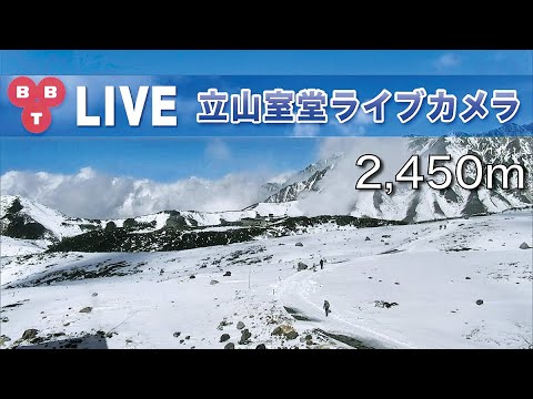
Descend to city history at Matsumoto Castle, compare high-alpine drama on Tateyama Murodō, or shift to hot-spring town ambience at Yubatake in Gunma.
Frequently Asked Questions
Is Kamikōchi open year-round?
No—routine access is mid-April to mid-November; winter closes the valley to standard tourism.
Can I drive to Kappa Bridge?
Private vehicles are restricted; use buses from Shin-Shimashima, Matsumoto, or Takayama.
Why is it called Kappa Bridge?
Folklore links the Azusa to kappa water spirits; the name survived multiple rebuildings and was popularised by Akutagawa’s 1927 novel.
How crowded is the bridge?
Peak summer and October foliage weeks can be very busy; shoulder seasons are quieter.
Is the live stream always available?
Broadcasting may follow park seasons and operator schedules—expect offline months in winter.
How far is Matsumoto city?
About two hours by train and bus combined—plan a full day minimum for a valley visit.
Which YouTube channel hosts the stream?
The embed resolves through channel UCVUyX8T-vYwJYraM6957r9Q, associated with Kamikōchi area tourism broadcasting—check live status seasonally.